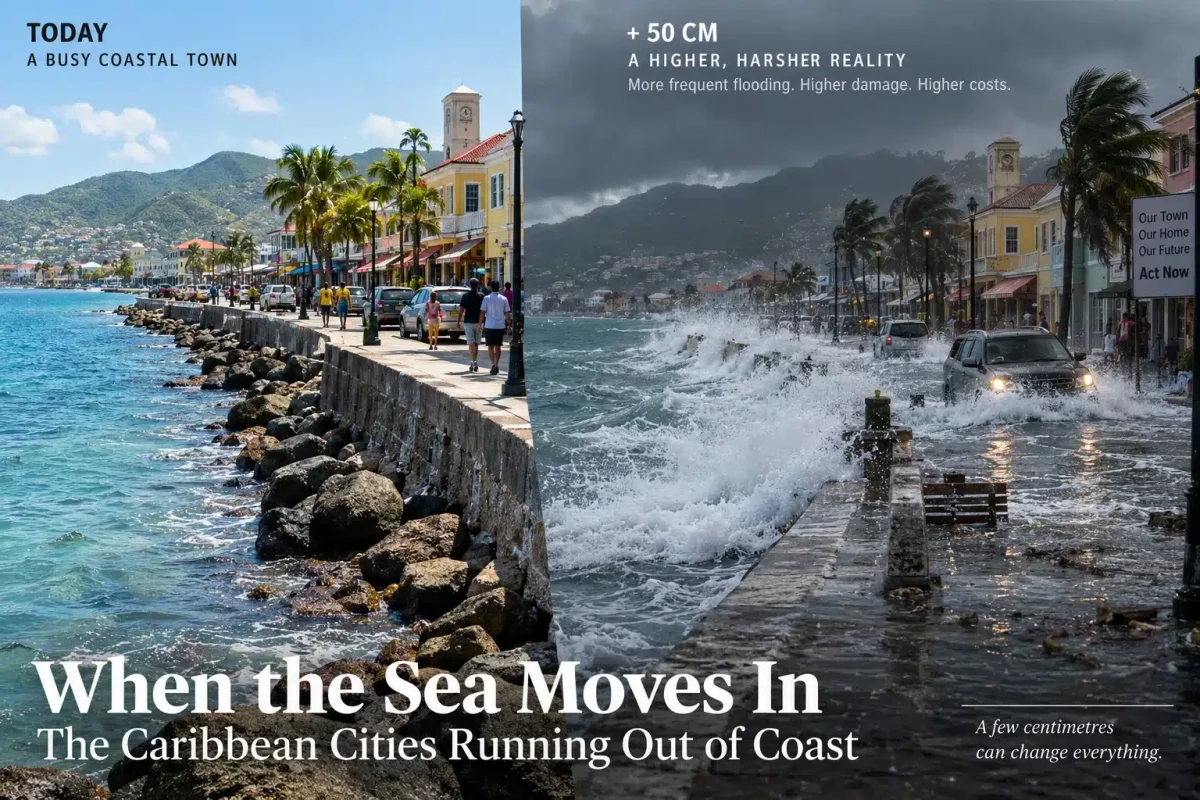
The sea does not have to swallow an island to change the way people live on it. It only has to come a little closer.
A road that used to flood during an exceptional storm begins flooding more often. Salt water reaches places where it did not before. A hotel discovers that the beach in last year’s photographs is narrower. A municipality repairs the same piece of coastal road again and begins to wonder how many times it can afford to do so.
For the Caribbean, these are no longer questions for the end of the century.
The IPCC projects that relative sea level around small islands will continue to rise. Depending on global emissions, regional average increases toward the end of this century could range roughly from 40–60 centimetres under a low-emissions scenario to 70 centimetres or considerably more under a very high one. More immediately, the frequency and consequences of coastal flooding on small islands are expected to increase significantly from around mid-century.
Forty centimetres measured against a wall does not look like much. On a coastline it changes the starting point from which high tides, waves and storm surges operate.
The question for Caribbean governments is therefore not simply how high the sea will eventually rise. It is what happens to everything we have already built beside it.
Georgetown and the seawall
There may be no better Caribbean place to understand the problem than Guyana.
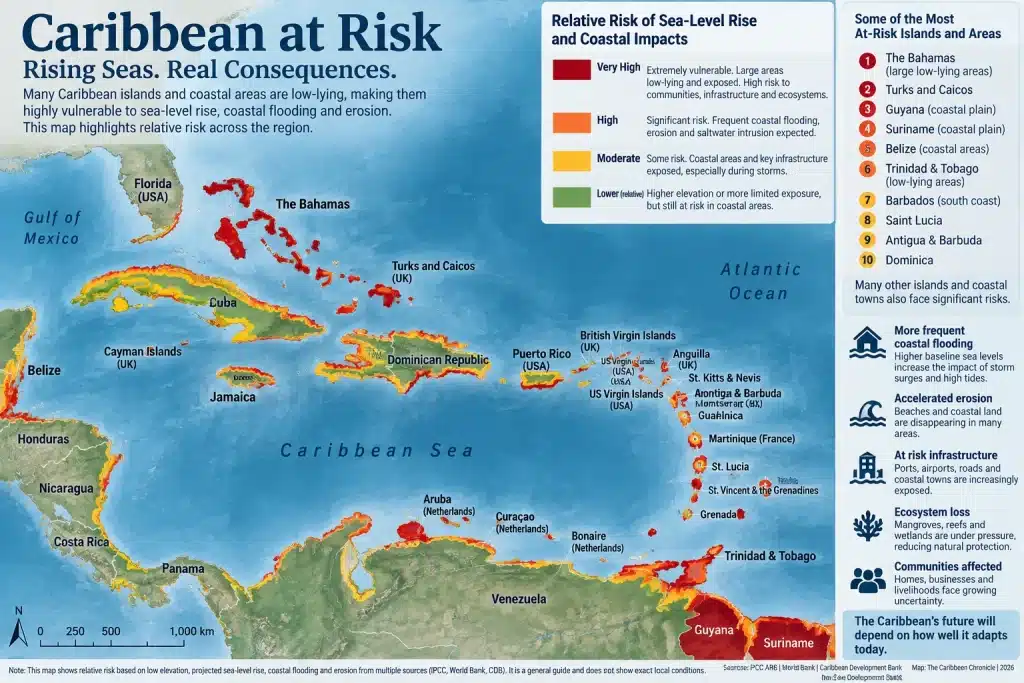
Much of the country’s population and economic activity is concentrated on its low coastal plain. The Caribbean Development Bank has estimated that about 90 percent of Guyanese live along a coast that is below sea level at high tide, protected by seawalls and other defences.

In Georgetown, the seawall is not some remote piece of climate infrastructure. It is part of the city. People meet there, exercise, eat, talk and watch the Atlantic. Behind it are houses, businesses and roads.
Keeping that system working costs money.
In 2025 the World Bank approved US$156 million for transport improvements in Guyana, noting that many coastal roads sit on low-lying plains exposed to rising seas, heavier rainfall and flooding. The 2021 floods alone caused more than US$100 million in damage to agriculture and transport.
Guyana now has something most Caribbean countries would envy: oil revenues large enough to transform the country. Some of that new wealth will inevitably have to go into keeping roads dry and maintaining the coastal defences behind which most Guyanese already live.
Flooding in New Providence
New Providence has another version of the problem.
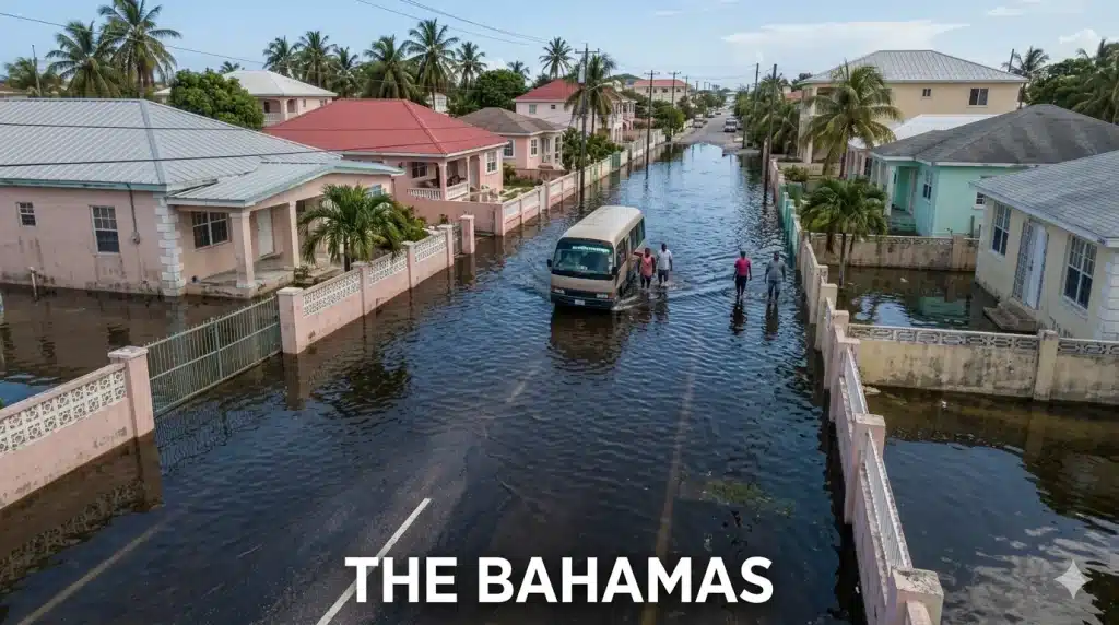
When heavy rain overwhelms drainage, roads flood. Cars slow or turn around. Workers arrive late. Parents have difficulty collecting children. Shops lose customers. Emergency vehicles have to negotiate the same water as everybody else.
None of this looks particularly dramatic on a climate map. For residents it can mean a road they cannot use, a school run that takes twice as long or a business that loses another afternoon.
The Bahamas is undertaking an US$80 million programme to improve drainage and make important roads on New Providence more resilient to recurrent flooding. The IDB estimates that more than 296,000 residents will directly benefit.
That is what climate adaptation often looks like in practice. Not an island disappearing, but a government spending millions so that people can continue using streets that are already there.
Barbados buys time
Along the southern coast of Barbados, between Rockley and Coconut Court, the familiar boardwalk is also part of a much larger coastal-engineering effort.
Barbados built breakwaters and retaining structures and replenished beaches. According to the IDB, the work increased average beach width in the project area by nearly 20 metres. Businesses benefited too: in an earlier survey, half of businesses responding in affected areas reported increases in monthly revenue of as much as five percent.
In Barbados a beach is not just scenery. It protects the coast, gives residents public space and is also part of what the tourism industry sells.
That makes erosion an economic problem as much as an environmental one.
The World Bank has estimated that, under a moderate climate-change scenario, 13 percent of seaside hotels in the Caribbean could experience beach loss by 2050. In some countries, annual coastal-protection costs could exceed five percent of GDP.
Barbados can put sand back on a beach and build structures to help keep it there. Doing so repeatedly across hundreds of kilometres of Caribbean coastline is another proposition.
The problem with moving uphill
Saint Lucia illustrates one of the peculiarities of small mountainous islands. Having high ground does not necessarily make them safe from coastal problems.
The mountains themselves push much of the useful infrastructure toward the narrow strip between mountain and sea.

Nearly 60 percent of Saint Lucia’s population lives in low-lying coastal zones, where much of the country’s critical infrastructure, including the airport, seaport and major roads, is also located. Castries and the fishing community of Anse La Raye are particularly vulnerable to flooding. A US$25 million flood-resilience project announced in 2025 is expected to benefit almost 67,000 people.
There may be perfectly safe land hundreds of metres above sea level. That does not solve the problem of a runway, container terminal or main highway that has to remain near the coast.
This is repeated across the region. Airports need flat land. Ports need the sea. Tourism wants beaches. Fishing communities have good reasons for living beside the water.
Moving everything inland is easy to suggest from a conference room.
Behind the postcard in Montego Bay
Montego Bay is usually sold through beaches, hotels and blue water. The infrastructure behind the postcard is less visible.
An IDB assessment identified a power plant, substations and hotel generators in areas susceptible to coastal flooding. It also found that storm surge could threaten the wastewater treatment plant at Bogue Village. Flooding there could affect coastal water quality and, eventually, the beaches on which much of the local economy depends.
A hotel does not have to be flooded for tourism to suffer. A damaged electrical installation, sewage system or access road can be enough.
This is one reason the cost of sea-level rise is so difficult to calculate. The damage does not stop where the water stops.
When protection is no longer enough
There is another option, and it is much harder politically.
Sometimes a community moves.
The IPCC cites Boca de Cachón in the Dominican Republic as an example of a community relocated to higher ground. Jamaica has also developed relocation approaches for vulnerable communities.
On paper, relocation can look straightforward. Build new houses somewhere safer, install roads, electricity and water, and move the residents.
People do not necessarily experience it that way.
A new house does not reproduce the neighbour who lived across the street for forty years. The little shop may no longer have the same customers passing its door. A fisherman may be safer but farther from his boat. Families leave behind places carrying memories that do not appear on a property survey.
That will make relocation one of the more difficult choices facing Caribbean governments. The engineering may be the easy part.
Belize did it once
The region already has a remarkable example of a government deciding that an important national function should move inland.
Belize City was the country’s capital when Hurricane Hattie struck in 1961. The devastation helped drive the decision to construct a new capital away from the coast.
That city became Belmopan.
Belize City did not disappear. It remains the country’s largest city and economic centre. But the government moved.
It is difficult to imagine today’s Nassau, Bridgetown, Kingston or Georgetown being abandoned and rebuilt somewhere else. That is probably the wrong way to think about it anyway.
The decisions are more likely to come piece by piece.
Move this school. Raise that road. Protect this neighbourhood. Stop rebuilding something else.
Over several decades, those individual decisions can change a city.
Not every defence is made of concrete
Caribbean coastlines had their own protection long before engineers began pouring seawalls: reefs, mangroves, dunes, beaches and coastal vegetation.
The IPCC found that coral reefs can dramatically reduce incoming wave energy. It also cites an interesting example from Saint-Martin/Sint Maarten after Hurricanes Irma and José in 2017. Where dense native coastal vegetation remained, marine flooding and shoreline retreat were confined to a strip of about 30 metres. In deforested areas, the affected distance exceeded 160 metres.

That does not mean planting mangroves solves sea-level rise. Some places will need substantial engineering.
It does mean governments should think carefully before removing natural coastal protection to build something that will later require an expensive artificial defence.
Who gets protected?
This may eventually be the most difficult question.
What gets a seawall? Which road gets raised? Which beach gets replenished? At what point does repairing the same vulnerable infrastructure stop making sense?
Money complicates the answer.
A large resort employing hundreds of people may generate enough economic activity to justify millions in coastal protection. Fifty families in a fishing community may not produce the same result in a cost-benefit analysis.
The spreadsheet may favour protecting the resort. The families in the fishing village are unlikely to see the decision quite the same way.
The same problem appears between countries. Wealthier Caribbean states can finance drainage systems, coastal engineering and stronger infrastructure. Smaller and poorer islands may depend on development banks and climate finance for projects they know they need but cannot afford themselves.
And the bills will not arrive all at once.
One year it is drainage. Another year a section of road. Then beach replenishment, a damaged pier or another seawall.
Insurance costs may rise long before a property becomes physically uninhabitable.
The World Bank says the number of Caribbean people exposed to floods increased by about 70 percent between 2000 and 2020.
Meanwhile, the IPCC concludes that almost all Caribbean port and harbour facilities will eventually face some degree of inundation risk without adequate adaptation.
Ports, unfortunately, have limited possibilities for moving away from the sea.
So do fishing villages. And beaches.
The Caribbean has always lived beside the water because the water is part of its economy and its identity. It brings visitors, carries trade, feeds people and connects islands that otherwise would be separated from one another.
Nobody is suggesting turning away from it.
Nor are the islands disappearing tomorrow.
But keeping many of the places we have already built beside the sea is going to become steadily more expensive.
And somebody will have to decide what is worth protecting.